Maps showing the growth of Bristol
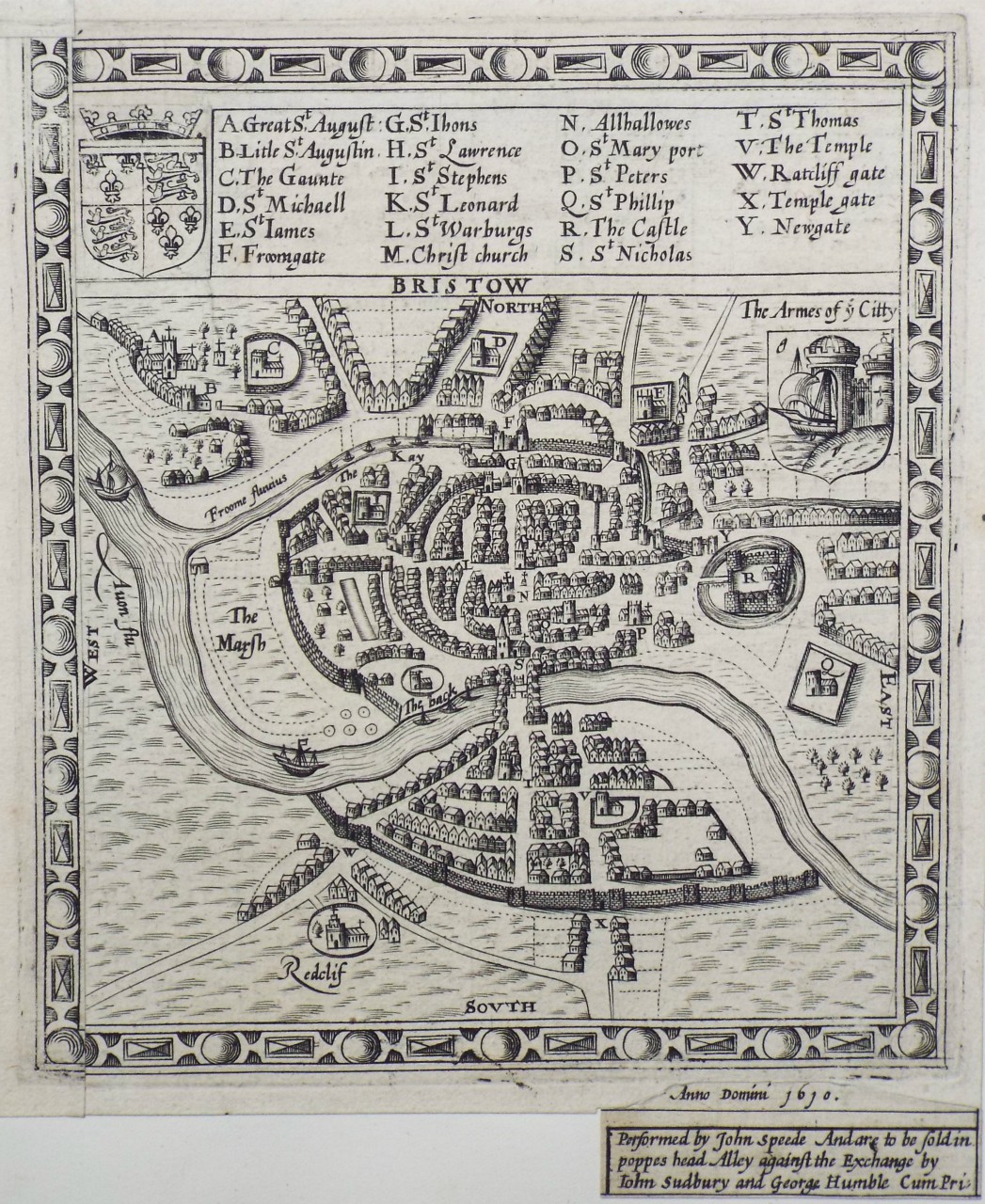
Medieval Bristol was an over-crowded city hemmed in by the city walls and rivers which defended it. Most of the lands outside the city walls were owned by the abbeys and church parishes, so the city became densely packed with tall houses. Even the bridge had 4 story houses built onto it to take advantage of the limited space. Poor sanitation and overcrowding made Bristol smelly and rife with diseases, but the opportunities for trade drew a growing population.
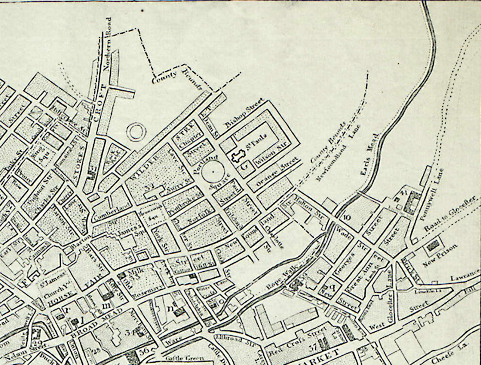
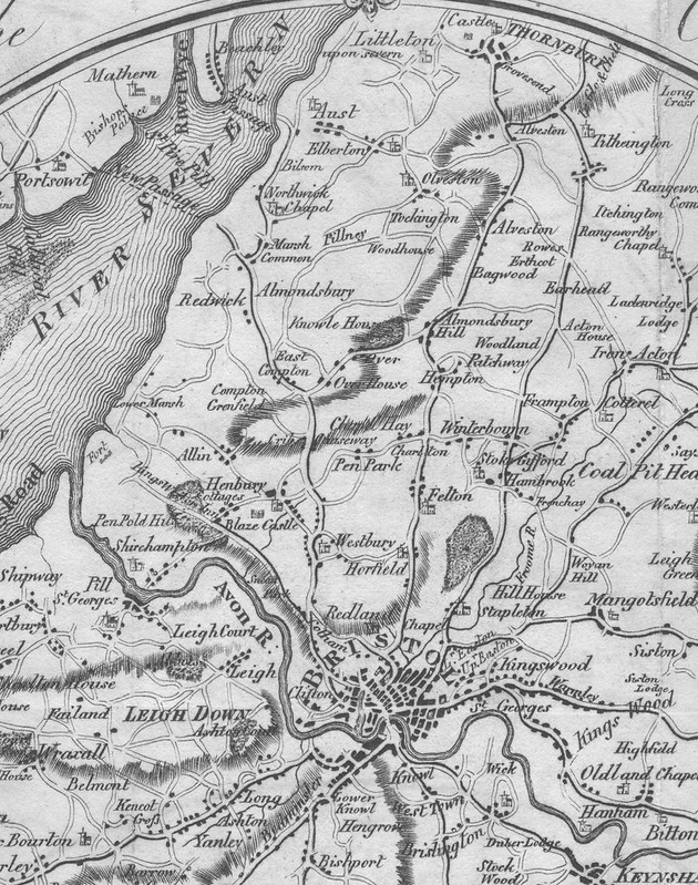
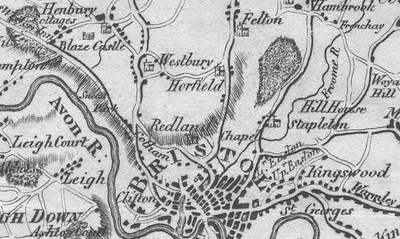
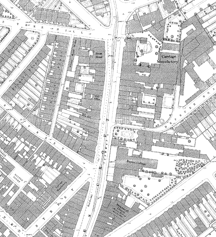
North of the crowded city, St James Priory and St Michael’s on the Mount Without (meaning without – or outside – the city walls) with their outhouses and farm buildings were the main landmarks. The remaining land was mostly farmland, with a few farm buildings.
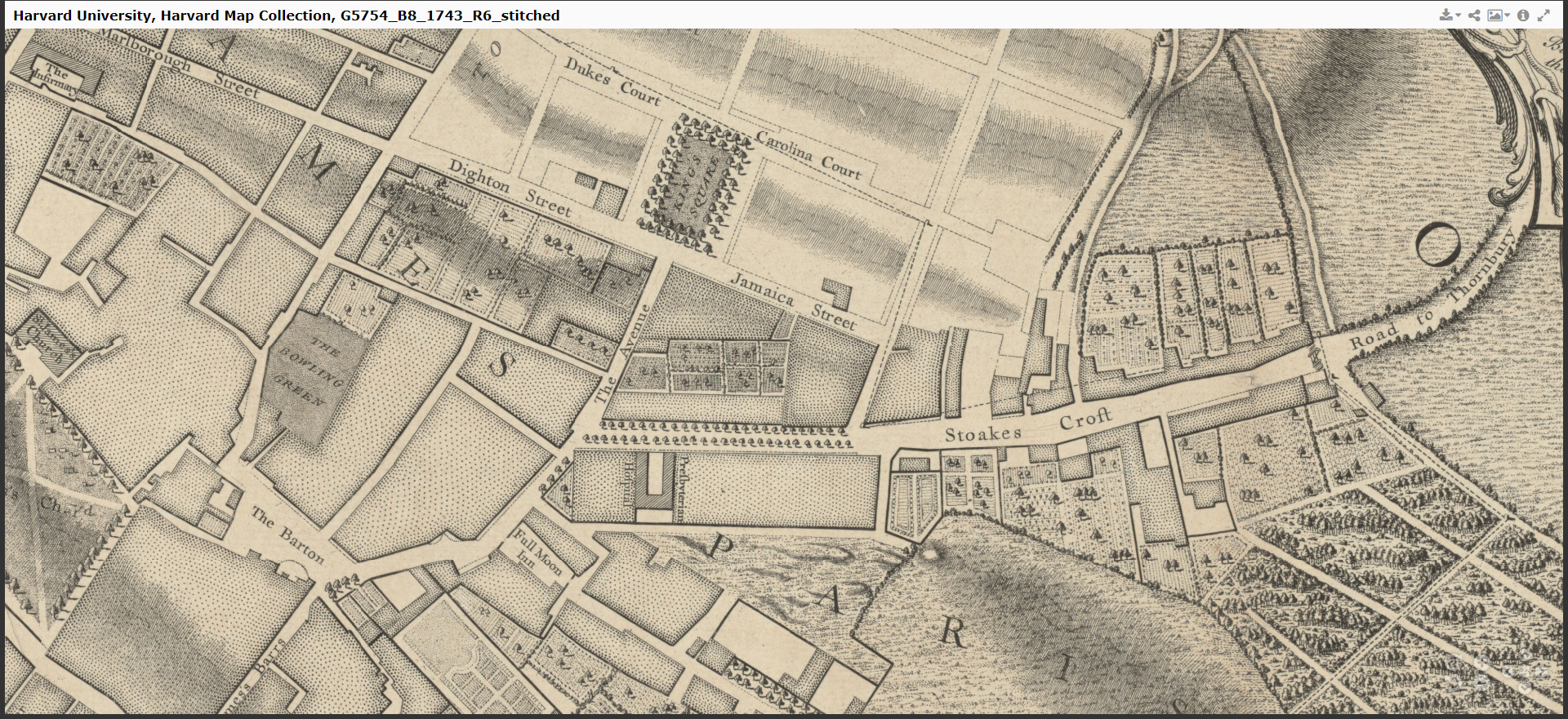
City mayor John Stokes was given lands just north of the city c.1364, formerly known as Berewykse Croft in Redeland. The muddy path leading through his farm became known as Stoke’s Croft.
Travellers who wanted to avoid the steep St Michael’s Hill/Horfield Rd route north to Gloucester and Thornbury, would take the Stokes Croft path, which gradually became more established, until it became an official turnpike road before the civil war, which was paved and maintained by the turnpike fees.
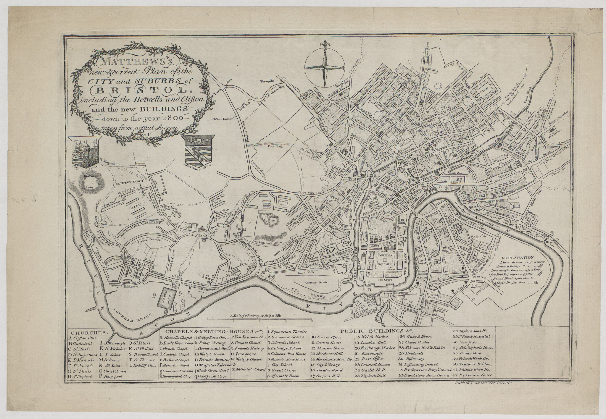
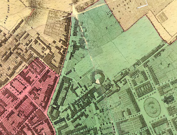
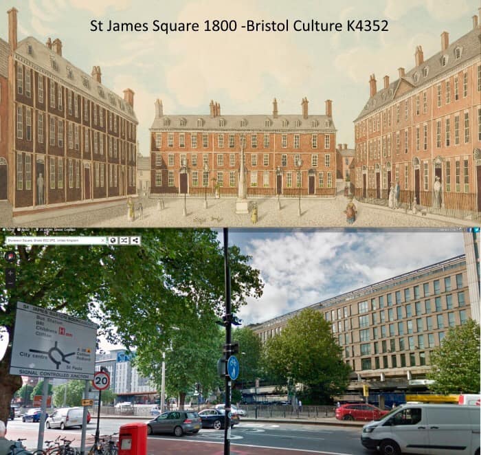
The reformation dissolved the monasteries during the reign of Henry VIII, leading to the sale of church and abbey lands outside the city. This was the first burst of expansion of Bristol. Following the hardships of the civil war and destruction of the castle, Bristol became a prosperous port city. Merchants became very wealthy, living in imposing houses in the large squares of St James Square, Brunswick Square, Portland Square and King Square, around the new suburbs of St Pauls and Kingsdown.
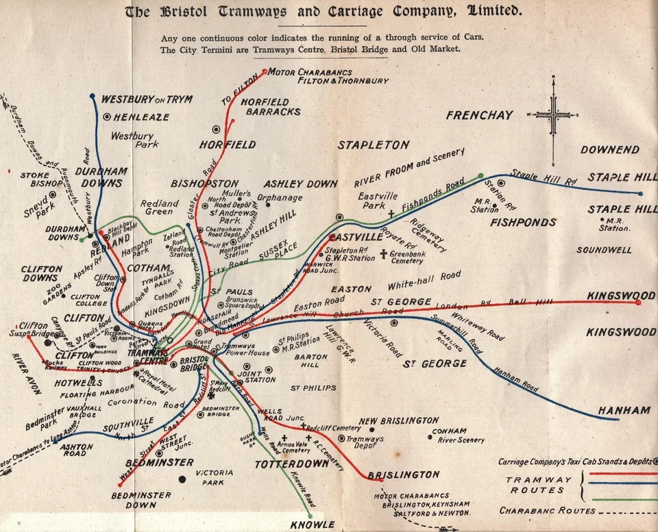
Stokes croft gradually became more urbanised, with several schools and businesses constructed on the undeveloped road, but in 1875 the tram network suddenly opened up the wider suburbs, until Stokes Croft became part of the inner city. Maps from the late Victorian era show densely packed streets stretching north from Stokes Croft, during the road’s most prosperous time.
A constant theme for Stokes Croft is its place outside the walls, or outside the city boundaries, where theatre, circus and fairs were able to take place, beyond the strict laws of the city. Originally, Stokes Croft was in Gloucestershire, and as the city expanded, the city’s boundary moved northwards, until the turnpike at the bottom of Ninetree Hill marked the city’s edge. Eventually, the city grew rapidly past this boundary, leaving Stokes Croft as part of the inner city. However, that outsider spirit survived when the area became neglected after the Second World War, where the once-grand street became a home for squat parties, popup art galleries, clubs, and street artists.
- Know Your Place: an invaluable resource which shows historic maps overlayed onto the modern street map of Bristol. You can also see historic photos and illustrations of locations on the map: https://maps.bristol.gov.uk/kyp/
- Bristol Information: a fairly detailed history of the Stokes Croft area, with lots of fascinating snippets of historical information: https://www.bristolinformation.co.uk/streets/stokescroft-00.php
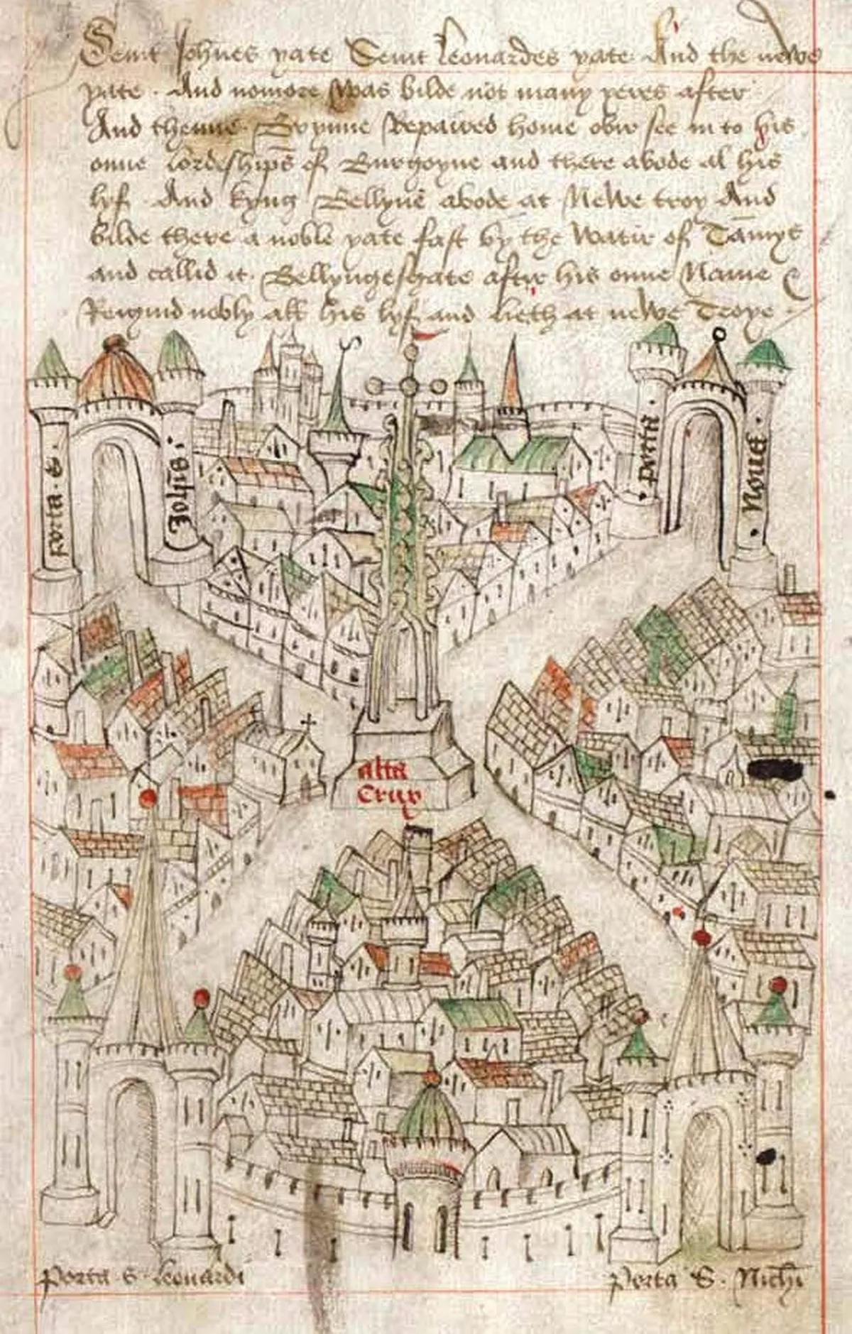
- Ricart’s Map: Information about Ricart and the earliest map of Bristol: https://www.buildinghistory.org/bristol/ricart.shtml
- 1673 James Millerd’s Map: Details from the first map of Bristol drawn from a measured survey: https://www.buildinghistory.org/bristol/millerd.shtml
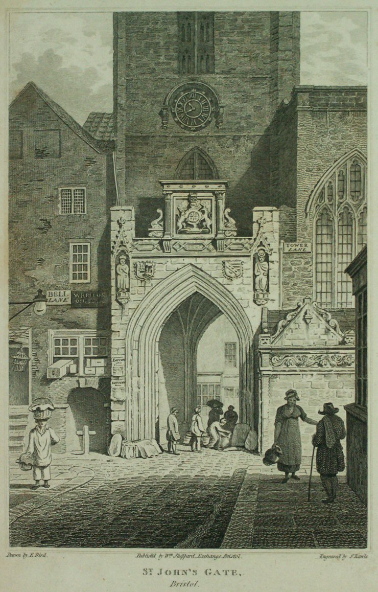
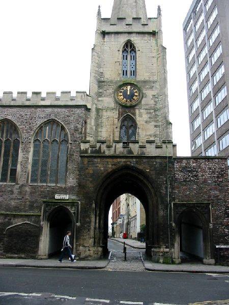
St James Priory
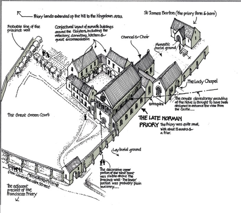
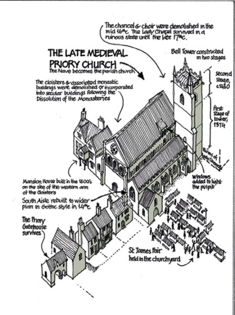
St James priory and church would have been the largest landmark in the area, which was surrounded by farm land and market gardens north of the city walls. Built in 1129 it is Bristol’s oldest building.


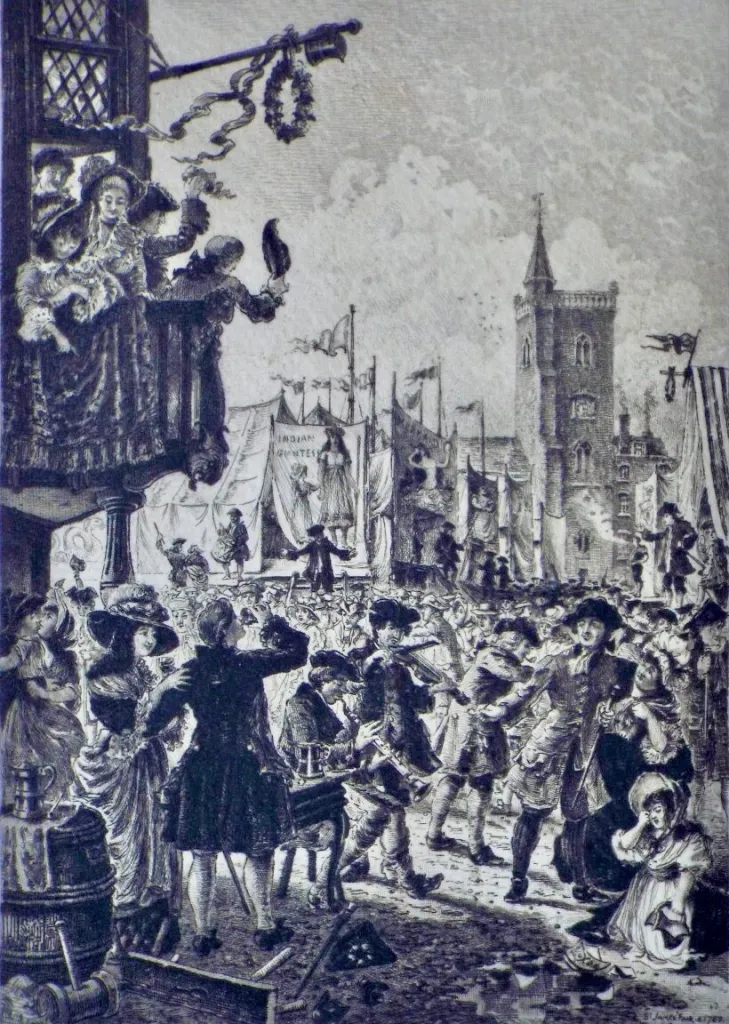
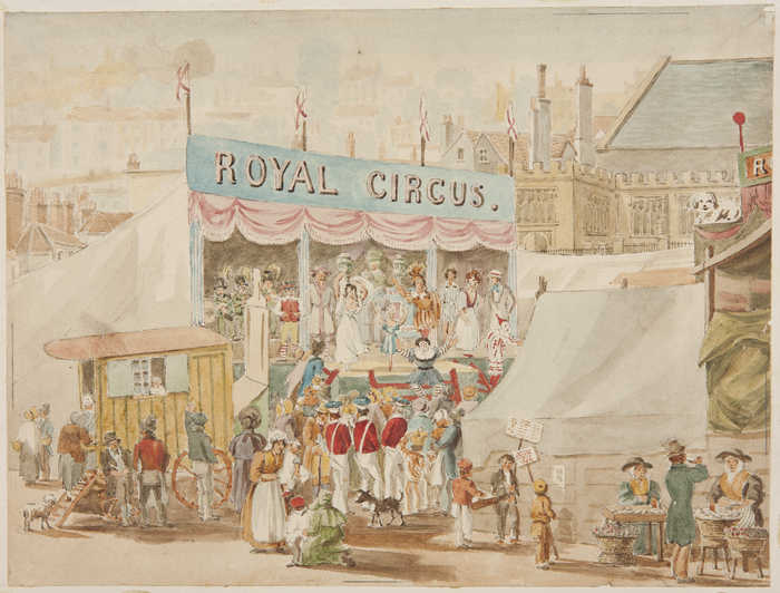
St James Fair
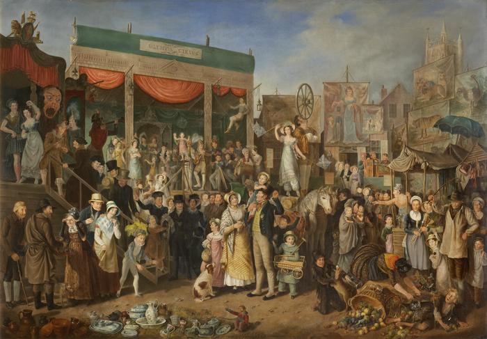
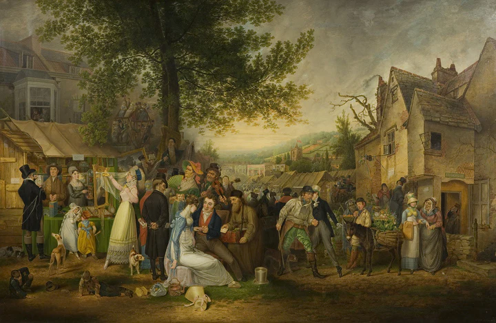
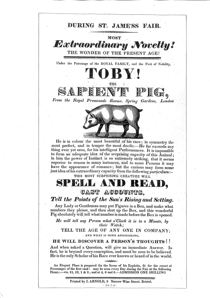
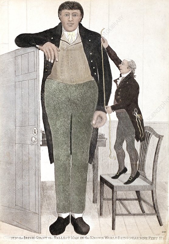
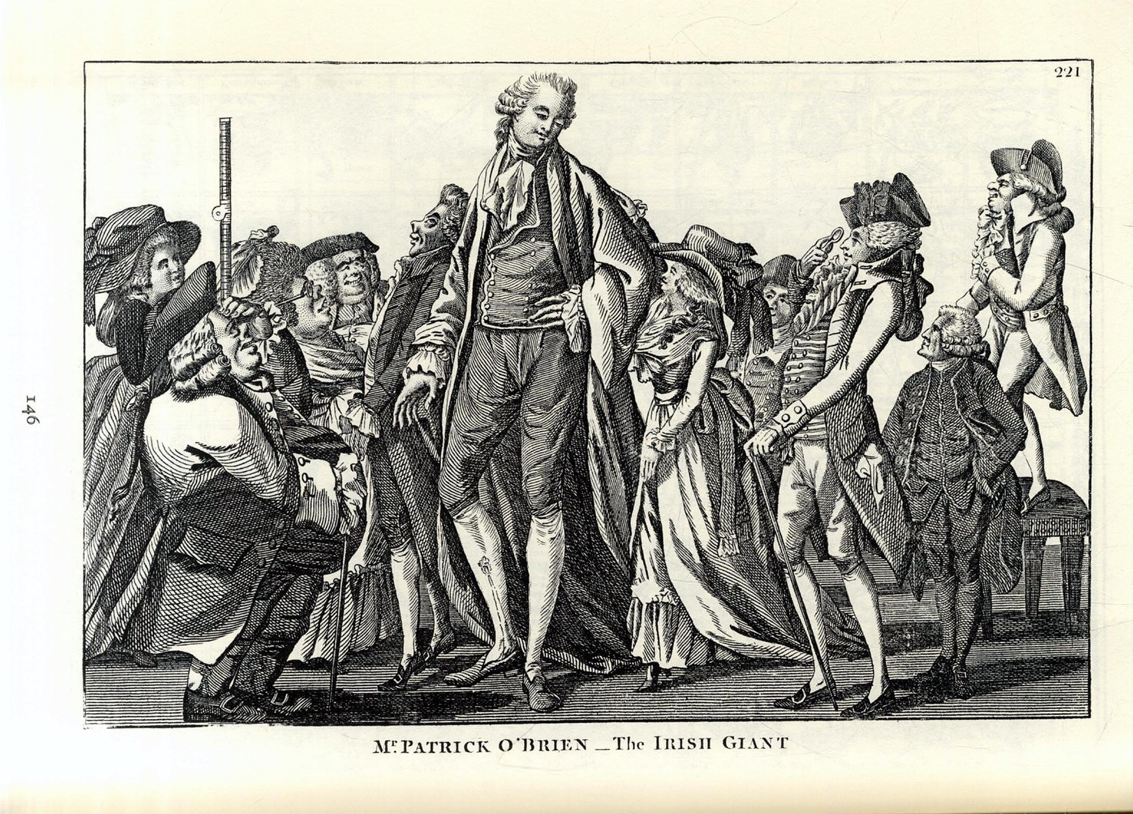
From 1238 an annual fair held over fifteen days, was held in the fields around St James Priory. The last fair was held in 1837. The closure of the fair provoked a riot. They were regarded as the most crime-ridden and dissolute markets in Britain, so famous that the Navy had to patrol the Bristol Channel at fair time to stop visitors being attacked or kidnapped by pirates and slavers.
“Blankets and woollens from Yorkshire, silks from Macclesfield, linens from Belfast and Lancashire, carpets from Kidderminster, cutlery from Sheffield, hardware from Walsall and Wolverhampton, china and earthenware from Staffordshire and other counties, cotton stockings from Tewkesbury, lace from Buckinghamshire and Devon, trinkets from Birmingham and London, ribbons from Coventry, buck and hog skins for breeches, hats and caps, millinery, haberdashery, female ornaments, sweetmeats and multitudinous toys from various quarters arrived in heavily laden wagons and were joined by equally large contributions from the chief industries of the district.
To these again were added nearly all the travelling exhibitions and entertainments then in the country – menageries, circuses, theatres, puppet shows, waxworks, flying coaches, rope-dancers, acrobats, conjurors, pig-faced ladies, living skeletons, and mummers of all sort who attracted patrons by making a perfect din. It need scarcely be added that the scene attracted a too plentiful supply of pickpockets, thieves, thimble-riggers and swindlers of every genus.”
John Latimer 1893


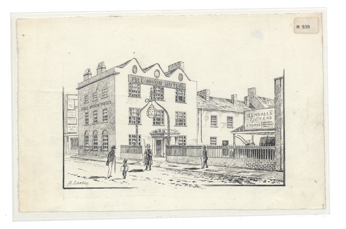
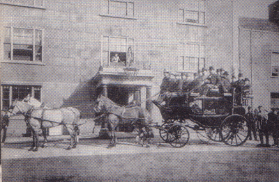
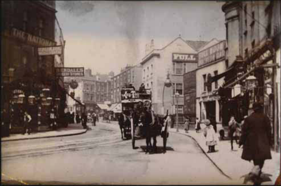
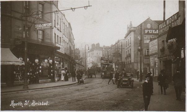
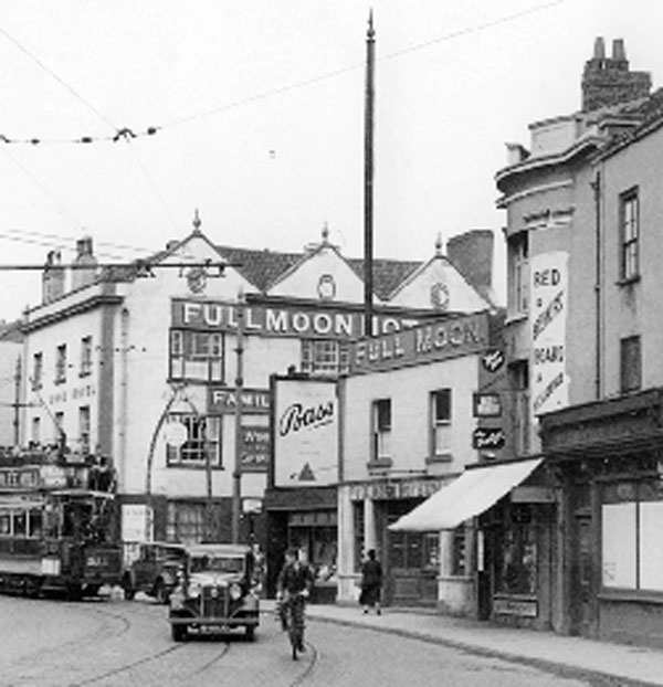
The Full Moon Inn
The Full Moon dates from 1716. It operated as a coaching inn, providing fresh horses for the express coaches that headed north. In the 18th century the inn had up to 10 coaches and vans per day operating, so it was the coach station of its day.
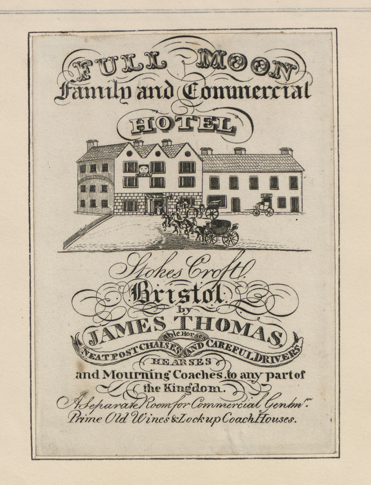
Some history about the Full Moon – the rest of the site has a lot of historic information about Bristol in general: https://www.buildinghistory.org/bristol/fullmoon.shtml
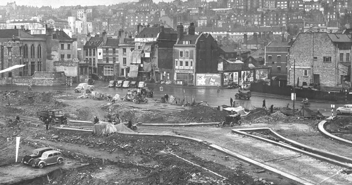
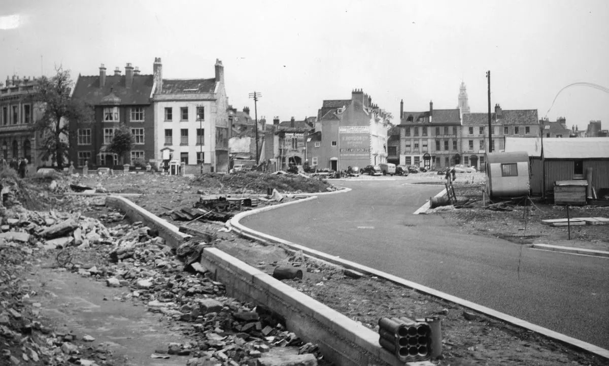
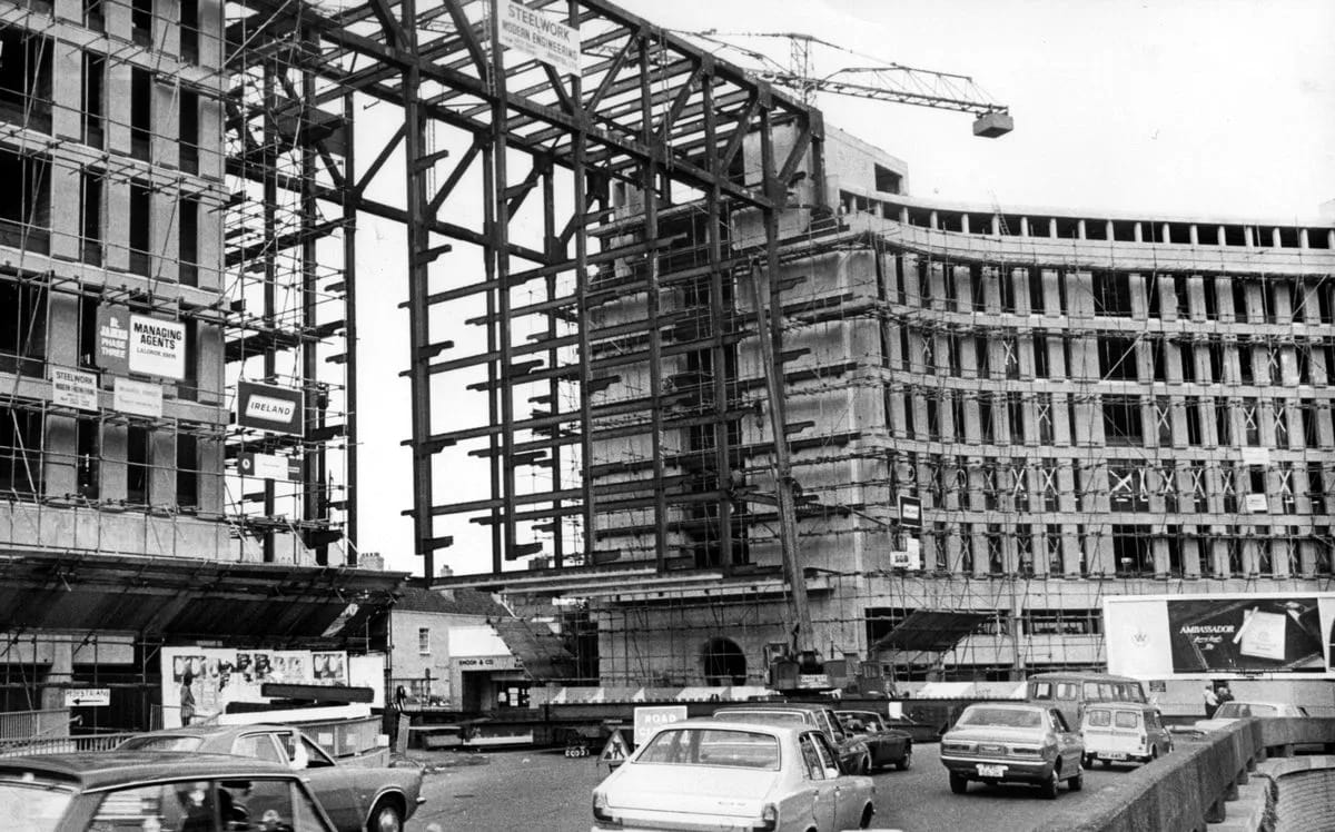
The lost square and redevelopment in the 50s
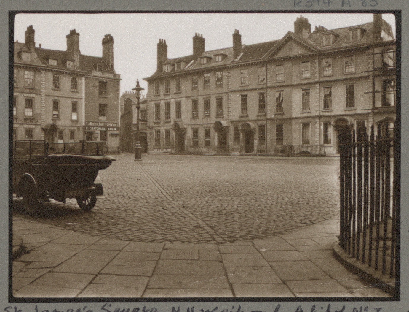
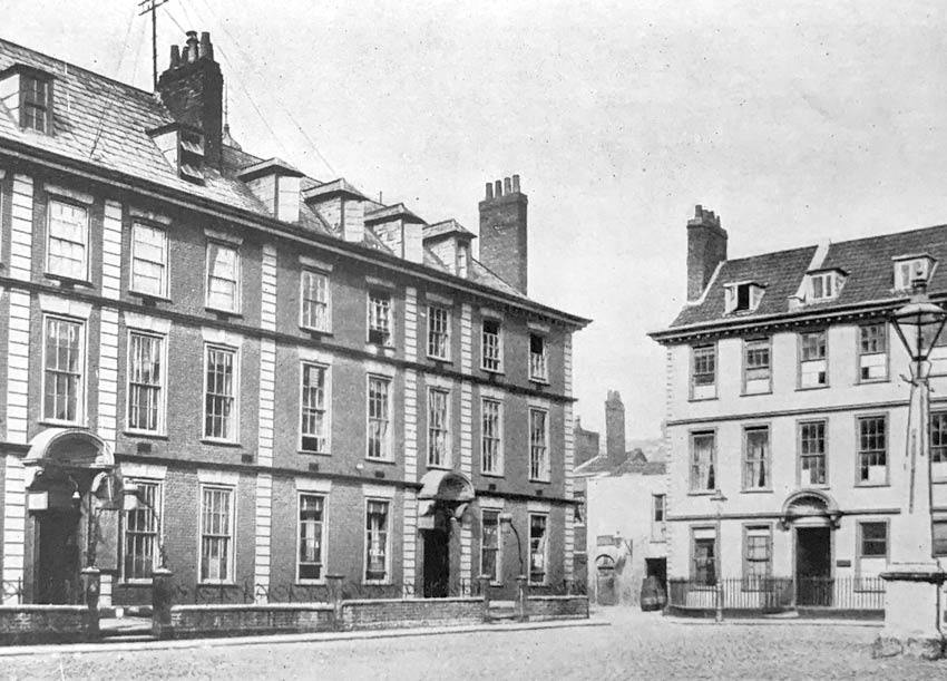
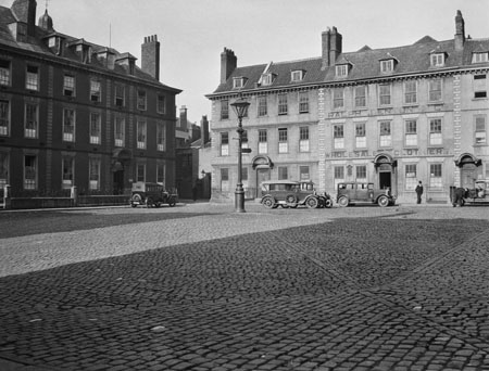
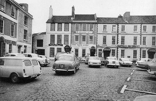
The St James Barton area has been completely rebuilt. Following the Blitz, much of the area was damaged or in such disrepair that the redevelopment removed whole streets. St James Square was a Georgian square in a similar style to Portland and Brunswick Square, which was removed for the road leading to the Bearpit.
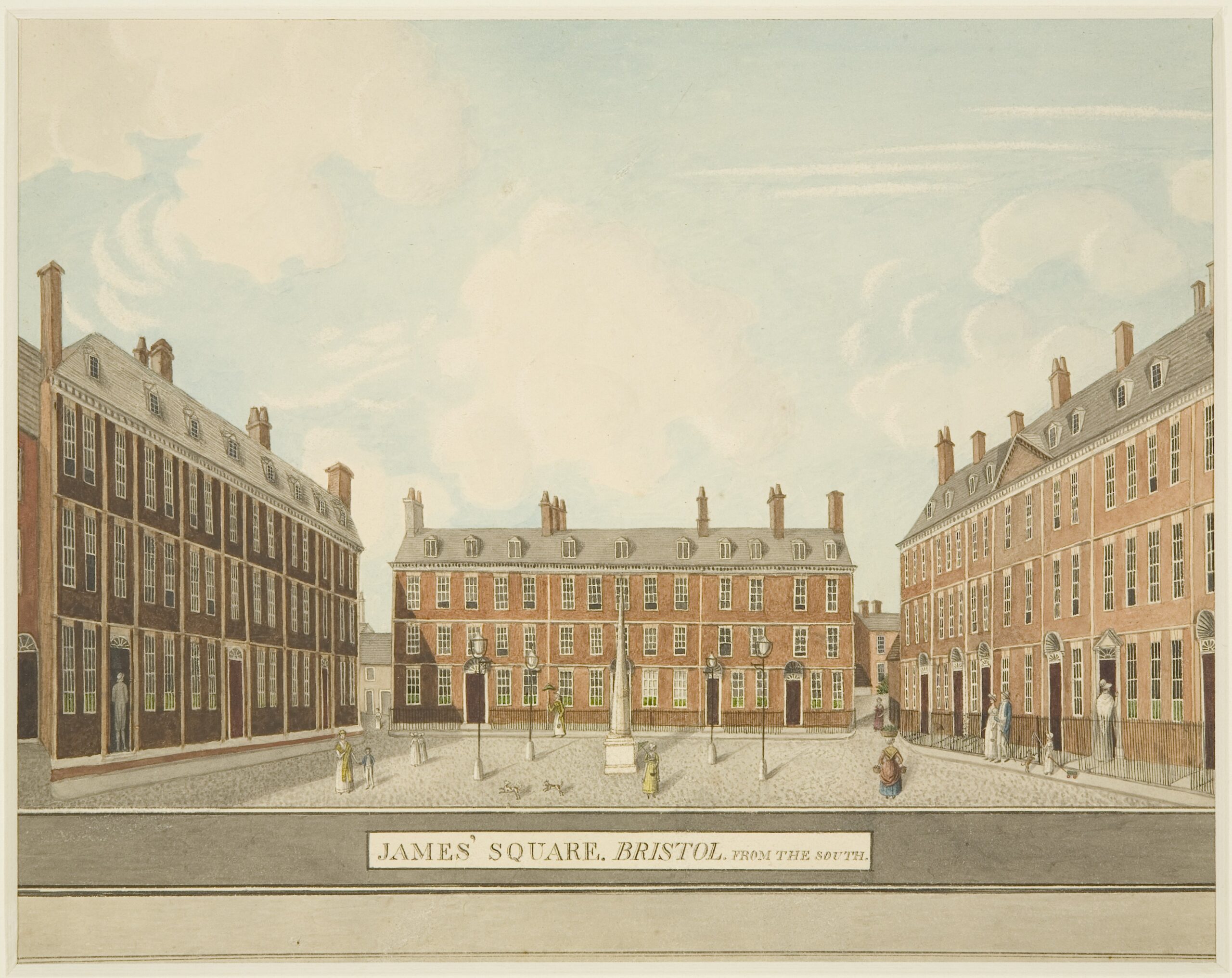
- Haunted by St. James’s Square, the square that isn’t there: https://precastreinforced.co.uk/2021/03/23/haunted-by-st-jamess-square-the-square-that-isnt-there/